SIM2Field
Precise Scaffold Execution from Digital Models
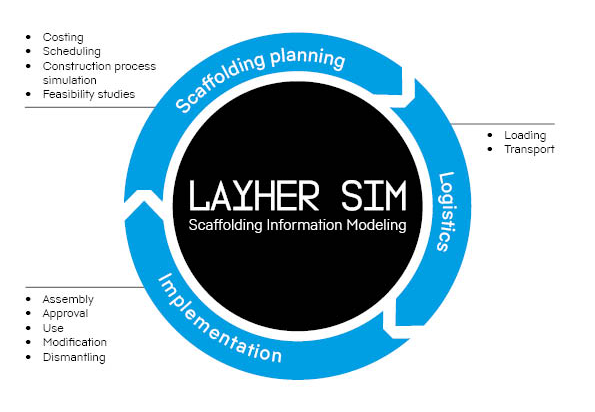
SIM2Field extends the Layher SIM® process into the field by enabling accurate, real-world transfer of 3D scaffold planning data to the construction site. It closes the loop between LayPLAN CAD planning and on-site execution, ensuring scaffolds are erected exactly as designed.

Workflow in Detail:
Step 1
Digital Planning
- All scaffolding structures are modelled in LayPLAN CAD, including geometry, terrain, and surrounding references.
- A minimum of three reference points are defined in the digital plan and linked to real-world markers on-site.
Step 1
Step 2
Stationing & Orientation
- On site, a total station aligns itself with the three reference points to establish orientation within the real environment.
- This eliminates manual guesswork and ensures the scaffold design is spatially aligned with the actual structure or terrain.
Step 2
Step 3
Positioning
- The scaffold base layout is projected onto the ground with laser points, allowing base spindles to be set directly to plan.
- Using a prism, both the position and height of scaffold elements can be verified with millimetre accuracy.
Step 3
Step 4
Assembly Support
- Crews follow the precise layout data, reducing reliance on paper plans.
- Errors in measurement and misinterpretation of drawings are avoided, even in projects with irregular geometry or complex industrial environments.
Step 4
Technical Advantages
- Continuous Digital Workflow – End-to-end use of LayPLAN CAD model data for layout, measuring, and erection.
- Accuracy – Millimetre-precise positioning ensures designs are replicated exactly in the field.
- Efficiency –Reduces setup time by eliminating rework due to misaligned scaffolds.
- Error Avoidance – No manual scaling from 2D drawings; the digital twin is directly referenced.
- Reduced Paper Use –Digital transfer minimises the need for assembly drawings on site.
Requirements
- LayPLAN CAD planning with reference to the actual environment.
- Three defined reference points in both the design and on site.
- A total station and prism for orientation and precise measurement.
- For projects without existing digital models, a 3D laser scan can generate geometry data for integration into LayPLAN CAD.